pygeometa project status
Tom Kralidis, Paul van Genuchten
2025-11-20
About us
- Tom Kralidis, Senior Geospatial Architect, Meteorological Service of Canada, OSGeo Board of Directors
- Paul van Genuchten, SDI specialist at
ISRIC - World Soil Information, the Netherlands
Intro to pygeometa
- Python package to manage metadata for geospatial datasets
- Created in 2009
- Originally named “pygdm” as part of larger internal geospatial data management workflow at Environment Canada
- Pulled out as a standalone project (pygeometa) in 2014
- Published to GitHub in 2015
Architecture
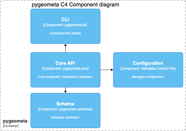
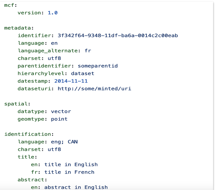
The Metadata Control File (MCF)
 {.fragment width=“100” .fig-align=“left”}
The Metadata Control File (MCF)
- agnostic to any metadata format (abstract model)
- plain old YAML
- migrated from
.iniformat in 0.2 - multilingual support for text-based properties
The Metadata Control File (MCF)
- benefits from YAML features (anchors, references)
- defined by a JSON schema
- model driven metadata workflow
- UIs
- in memory pipelines
- optimal for CI/CD and Git workflows (edit/publish)
Supported formats
- Dataset metadata
- ISO 19115 / 19139 (rw)
- ISO 19115-2 (w)
- WMO Core Metadata Profile
- OGC API - Records (rw)
- DCAT (w)
- Granule metadata
- STAC (w)
- Observing Station metadata
- WMO WIGOS Metadata Standard (w)
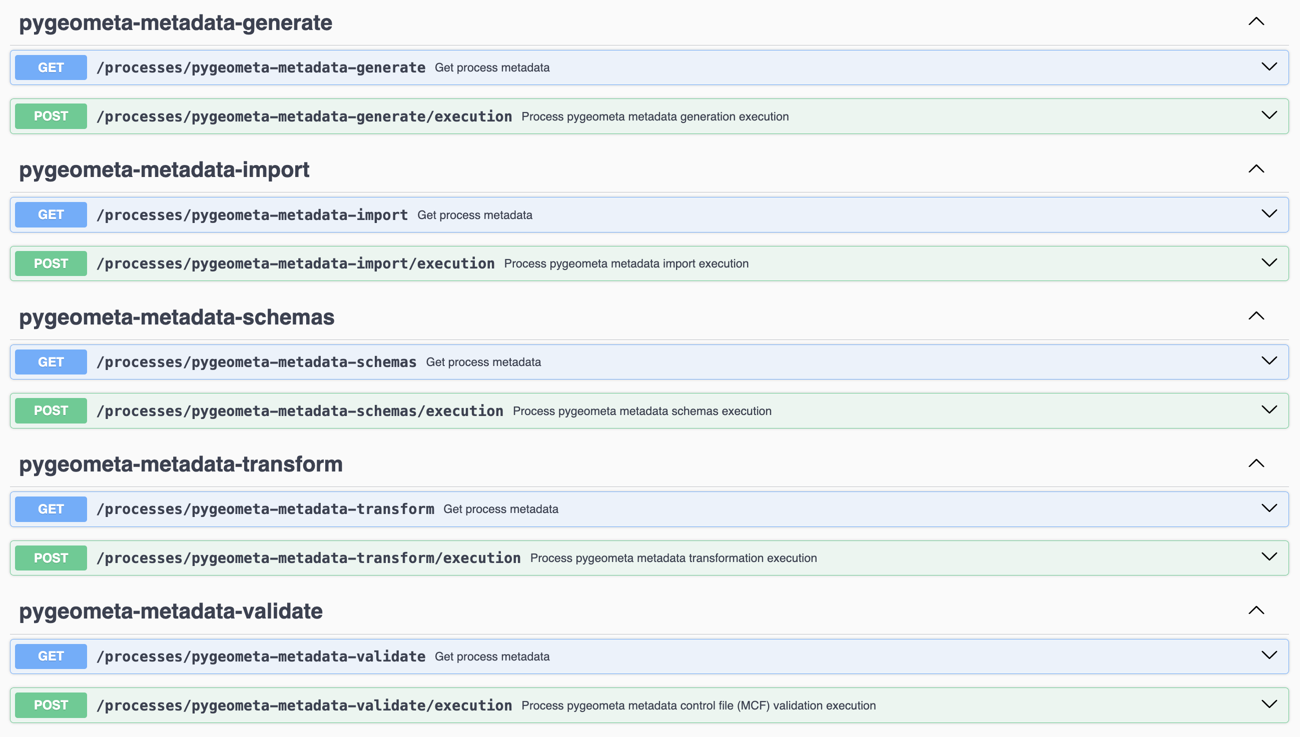
pygeoapi plugin
- functions exposed as OGC API - Processes endpoints via pygeoapi
- in
pygeometa/pygeoapi_plugin.py - live examples on pygeoapi demo server
 {.fragment width=“100” .fig-align=“left”}
Formats and extensibility
- Can be any format/representation
- extending
pygeometa.schemas.base.BaseOutputSchema - Generation is encapsulated
- XML: Jinja2
- JSON: Python
json
Recent updates
- 0.19.0 (November 2025)
- support for schema.org
- update to Python 3.12
- 0.18.0 (September 2025)
- support for Common Workflow Language (CWL)
- 0.17.0 (July 2025)
- support for metadata autodetection
Value proposition for YAML based metadata management
- YAML is an optimal format for Git version control
- Git offers a fully traceable catalogue
- File based metadata is easy to update with “search and replace”
- YAML can be composed and published in memory for automated pipelines
Workflow examples
- Data explosion = metadata explosion
- Traditional workflow:
- static discovery metadata
- Real-time workflow:
- Momentum data
- On-the-fly generation
- Ship with or without payload
Metadata publication use cases
We present 3 use cases to demonstrate the value of this approach:
- Land Soil Crop hubs (LSC)
- Earth Observation Exploitation Platform Common Architecture (EOEPCA)
- WMO Information System (WIS2)
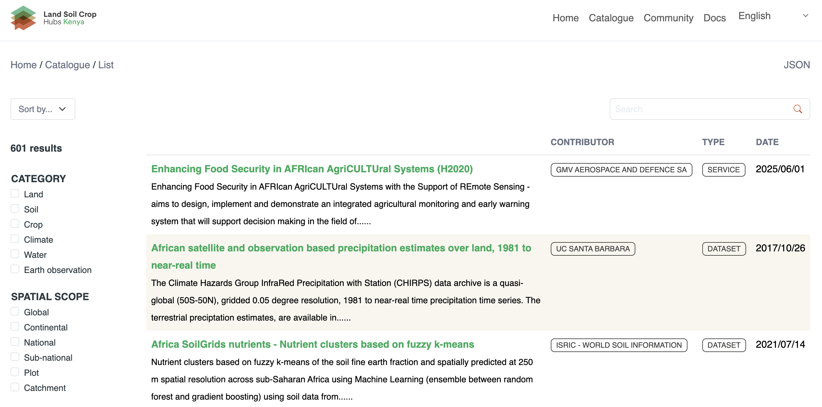
Land Soil Crop hubs
- Part of an EU funded research project, DeSIRA, to improve data sharing in the Land Soil Crop domain in East Africa
- Improve data & resources discovery, which are relevant to improve agriculture in East Africa
Participatory metadata management
pycsw
Participatory metadata management
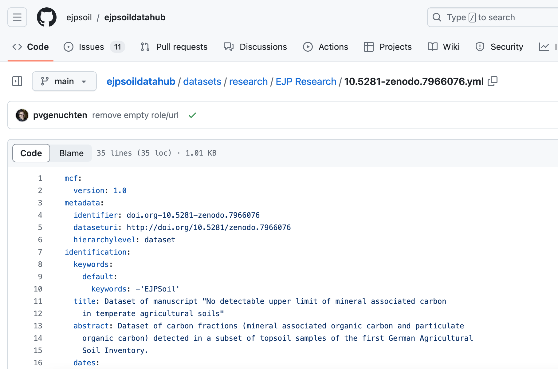
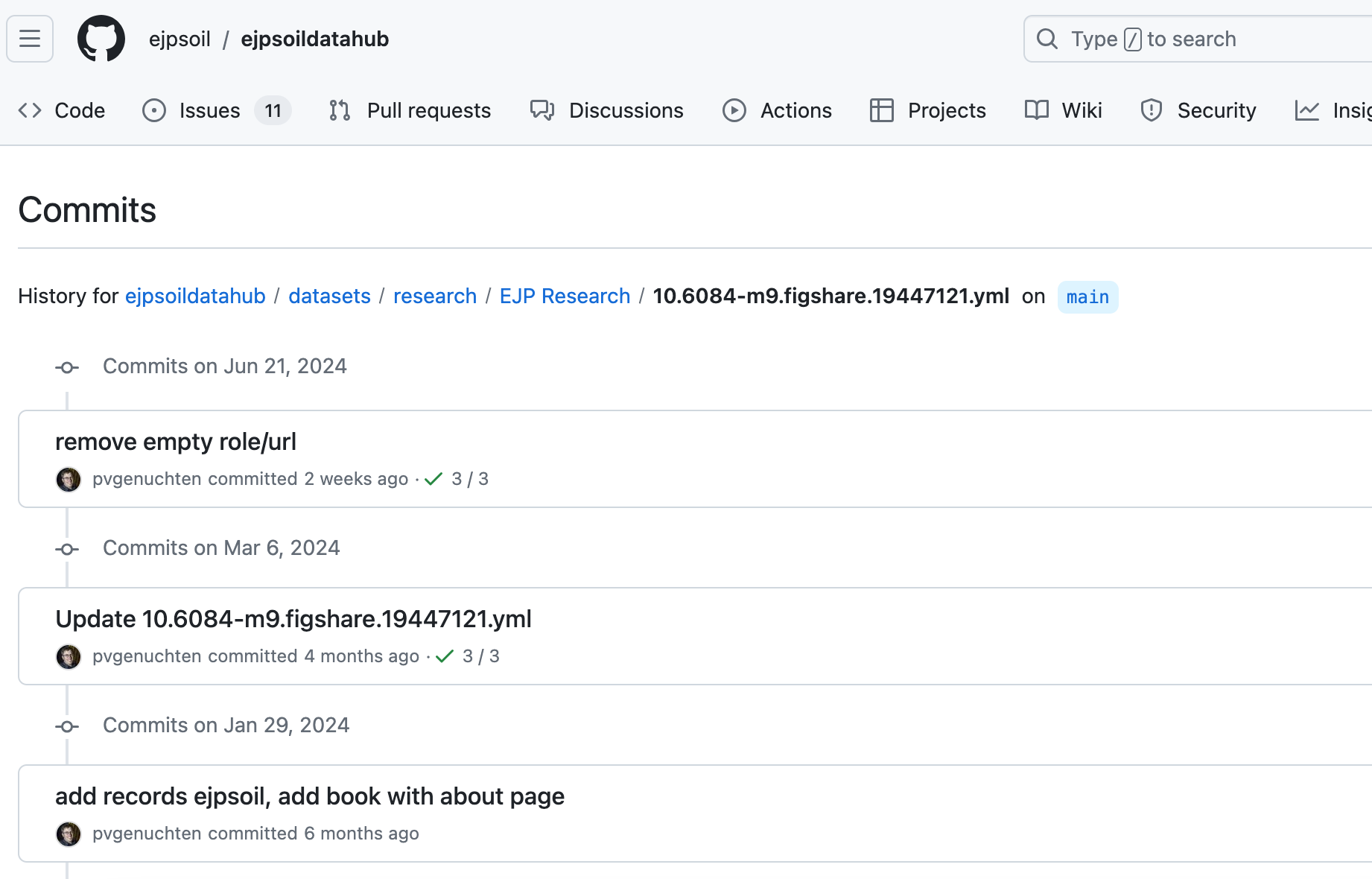
- Users initially provided metadata as lists in Microsoft Excel
- Excel rows converted to MCF and loaded to pycsw
- MCF Metadata is hosted in GitHub
- Users contribute content (or register issues about content)
EOEPCA
- Earth Observation Exploitation Platform Common Architecture (EOEPCA)
- Resource Catalogue (publishing, discovery and search)
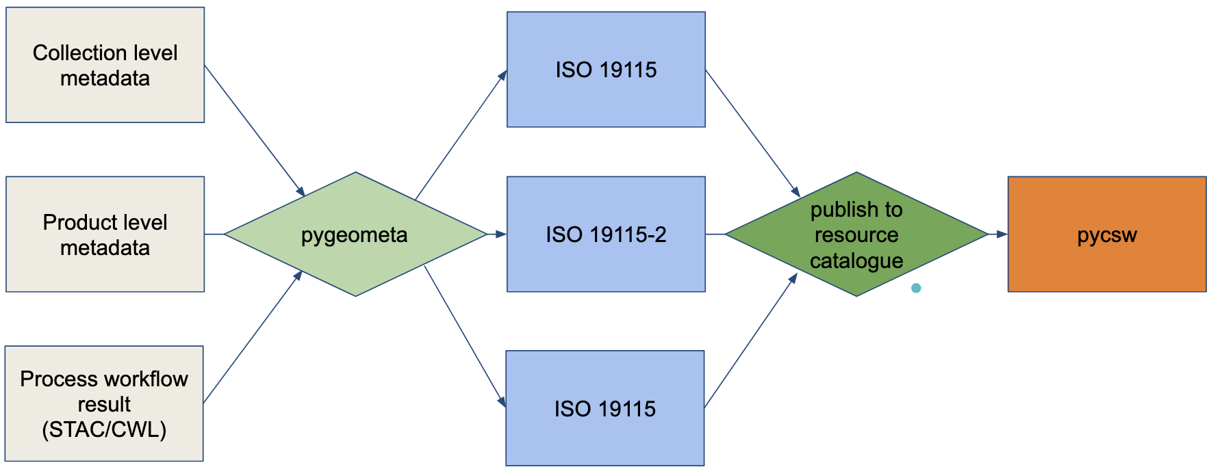
- Metadata publishing pipeline
- Collection level metadata
- Product level metadata
- Process metadata
- ISO 19115-2
- Sentinel scene metadata + INSPIRE => 19115-2
- CWL => 19115-2
- Publishing into pycsw
- CSW
- OGC API - Records
- STAC
EOEPCA
EOEPCA metadata workflows
WMO Information System (WIS2)
- WMO WIS2 is a next generation data exchange system for Earth system data (weather/climate/water)
- Event driven (Pub/Sub, MQTT), driven by OGC API - Records metadata and publication
- Set of tools adopted by regional weather offices to build up a global system
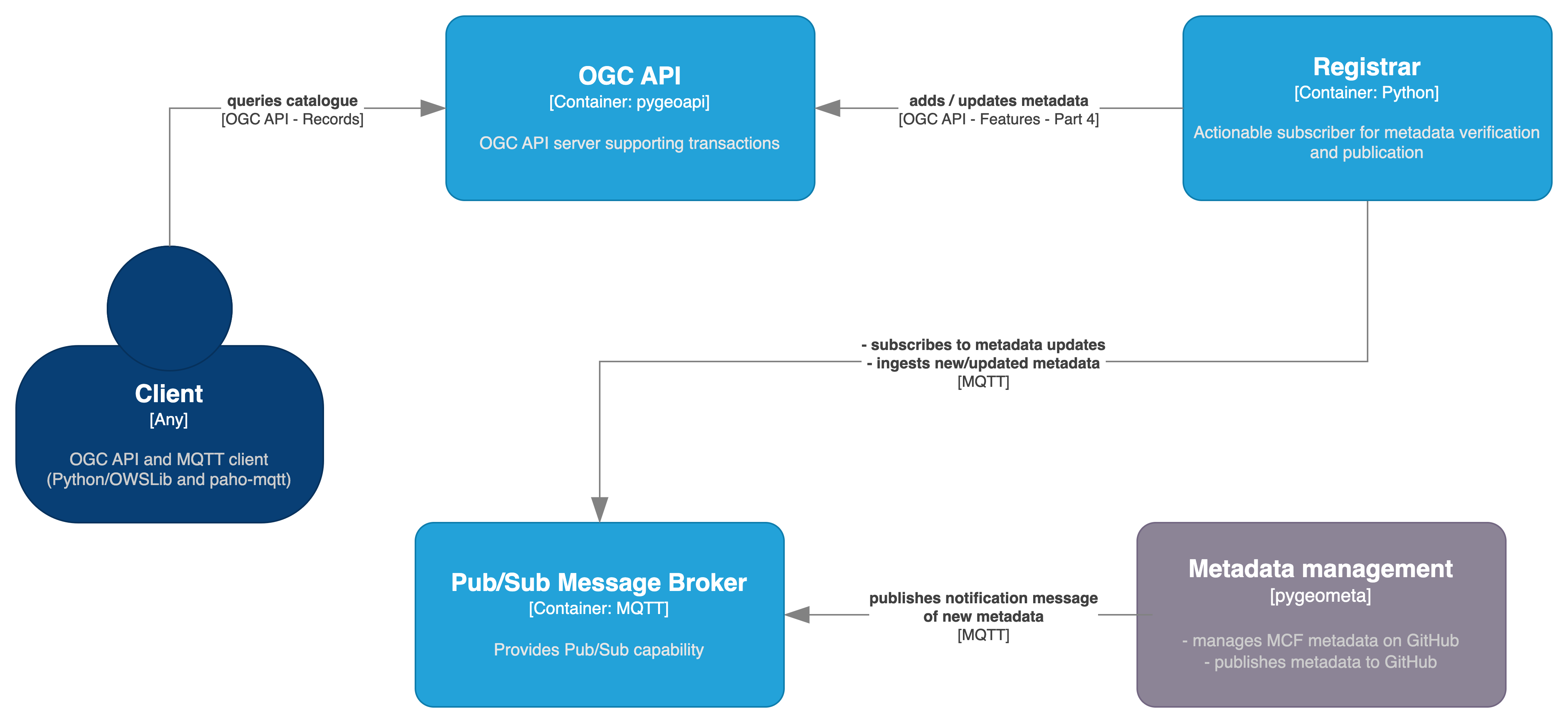
Workflow I
“No code”: Manage, verify and publish metadata using GitHub as a content management platform.
- Metadata files are managed as pygeometa MCF records
- GitHub Actions are used to verify, transform and publish notification messages to an MQTT broker
- From here, a metadata registrar is subscribed to the same MQTT broker and, on notification, verifies new/updated metadata and publishes to an OGC API - Records endpoint (powered by pygeoapi) using OGC API - Features - Part 4. The QGIS desktop application is then used to query the OGC API - Records endpoint using its MetaSearch search client.
Workflow II
Takeaways
- pygeometa is a small, ligthweight and composable metadata management utility
- MCF is an interesting and useful metadata format for embedded metadata in local file repositories
- Git storage and CI-CD workflows are a traceable, reproducible and participatory approach for metadata management
- OGC API - Records offers a clean machine and human friendly interface to metadata
- pycsw
- pygeoapi
- GeoNetwork Opensource
Composability

References
![]()
FOSS4G 2025, Auckland, New Zealand